Monday, 25 July 2016

Summer Cruise Day 14 - Marple to Bollington Wharf

Today we continued retracing our step by cruising from Marple.  The weather looked iffy and in fact later in the day just after we moored the rain arrived.

On our way we passed several herds of cows many with young calves the look only a week or two old.


Two calves relax whilst mum prepares dinner in the background
 A bit further on we were surprised to see some bushes really shaking and wondered why.  As we got closer we found these two carves in the cut eating the bushes.  See, I did say avoiding cows standing in the canal added entertainment.


White Nancy atop this hill 
 Sighting White Nancy meant we were approaching Bollington.  We wanted to moor at clarence Mill again but being Sunday we did not build up hope.  Just as well as the aqueduct was chocker with boats.  Oh well we thought we'll find somewhere else.  We managed to get on the last mooring at Bollington wharf.  Again we were moored opposite breasted boats but, with light traffic it was not a problem, there was plenty of room for one boat to pass.


Total distance:8.17 miles Elapsed time:4h13m38s Locks:0
Bridges:31 Average speed:1.93 mph (1.93 lock/mph) 


Sunday, 24 July 2016

Summer Cruise - Day 13 New Mills to Marple

Today we started retracing our steps back to the Trent and Mersey.  We had planned on continuing up to Huddersfield but reading Ian and Irene's  exploits with low levels and empty pounds we knew we would not get AmyJo up there so we trimmed that bit off our plans this time round.   You can read their blog here (click)

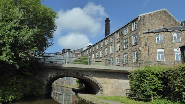
Another pleasant day saw us past Furnace Vale Marina and the Swizzles factory with those lovely smells again.

Swizzles factory at New Mills
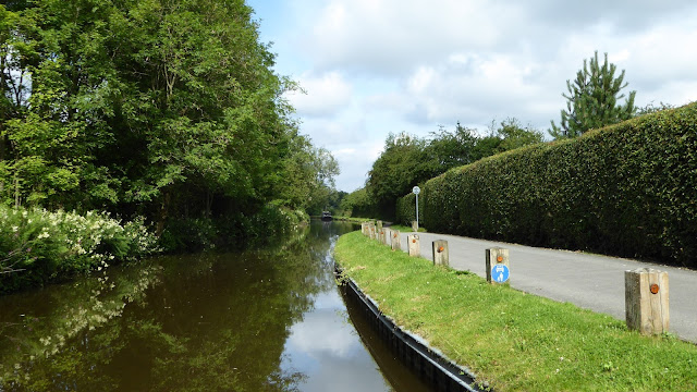
 Then on past Disley with these lovely maintained towpaths and banks

Even the posts had reflectors on them

An of course the Peak district is never far away.
 Remembering Chris had a bit of a struggle with the lift and swing bridges on our way up I volunteered to do them this time.  Chris is still nervous on the helm but she does herself an injustice as she maneuvered AmyJo with ease.  If she was bricking it she didn't let show especially with another boat following.

Time to work of that beer belly of mine

Chris looking rightly pleased with herself.

I do like this place, could happily settle there.
 The approach to Marple junction is preceeded in this direction by a marina.  Its not clear which way the cut goes from this viewpoint but a thoughtfully placed arrow guides one in the right direction.  I wonder how many have had to reverse out of the marina having not heeded the arrow?

The arrow is just between the cabin cruisers on the right, main line continues to the left
 It being a Saturday and rejoining the Cheshire ring we cautiously made our turn at the junction but surprisingly the way was clear, not even a boat coming up the locks.


Starting our turn left at the junction chris stood on the bow checking the way is clear

No traffic coming up Marple locks at this time
 Having passed through the gauging narrows we found a mooring just after the next bridge 'ole opposite the Ring-o-bells pub.  Hopefully it will not be too lively tonight.


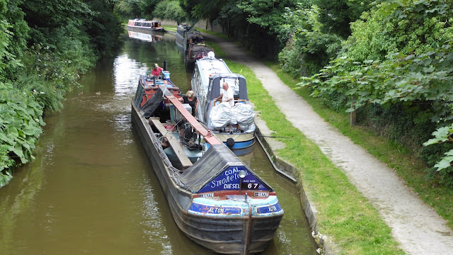
After lunch and whilst I typed up today's post Chris took herself off for a wander round the town.  We needed diesel and knew Brian on Alton was due in Bugsworth tomorrow PM so I stayed aboard incase he appeared as we knew he was close.

Chris was back before Alton arrived, in fact it was 6:30pm when Alton's Claxon heralded their arrival.  Brian and his wife were aboard and whilst we filled with diesel we chatted about our plans and where we were headed.  Brian offering great places to stop all seemingly by pubs.  I wonder why.

Alton coming alongside

Fill her up please Brian.
The rest of the evening was spent enjoying a great band playing in the Ring-O-Bells pub nearby.  Pretty good they were too.


Total distance:4.67 miles Elapsed time:2h28m38s Locks:0 
Bridges:13 Average speed:1.88 mph (1.88 lock/mph) 

Saturday, 23 July 2016

Summer Cruise - Day 12 Bugsworth to New Mills

If there was a prize for long distance cruising we certainly would not be in the running today. It was so quiet last night we slept solid until 8:30am.  We knew we would not be traveling far so a leisurely breakfast was had.

The sun was out again and our little spot in the basin was so warm and peaceful we were in no hurry to leave.  We do so love it here but our 48 hours were up so time to go.

Prepping AmyJo to Cruise.  Looks like another glorious day.

We slipped off the mooring and crept passed the boats moored in the middle basin and their crews out in chairs taking in the sunshine. 
I never tire of views like this

Almost picture postcard material
As we passed the wide Chris spotted this Heron high up on a tree.  He had been up there pretty much all the time we were there except to come down to fish. 


Can't look he'll hit something in a minute for sure.

First order of the day was to fill with water as Chris had caught up with her washing and we had several showers to cool off.  We pulled in in front of a boat on the water point and waited our turn.    Pedro, the basin warden, entertained us whilst we waited and saw to the numerous boats arriving trying to stop them from entering the now crowded lower basin so they did not have to reverse out.  He's quite the character and clearly loves working here.

Boat on the water point so we pulled in just in front of him.
Once full we headed off for the junction and the Whaley Bridge arm.  A simple metal bridge spans the cut at the junction with the Whaley Bridge arm off to the left of the picture.  We carried the bicycles over this yesterday and it's a bit bouncy as you cross which is a little un-nerving.


After passing long term moorings we managed to find a spot big enough for AmyJo and right opposite a large Tescos.  A large shop was called for so we filled up with all we needed.  We did not fancy lugging heavy shopping bags up the embankment and Tesco trolleys are supposed to stop beyond a certain perimeter of the shop.  Our luck was in as we crossed the perimeter and our trolley kept going!  In fact it kept going all the way back to AmyJo.  After unloading the shopping I took the trolley back so it did not end up in the cut.
  
Visitor moorings are just beyond these long term moorings.

Yours truly with the wayward trolley trying to disable the boat alarm with no signal on my phone.
Before leaving Chris had sorted out some clothes that were now too big for her but would fit our Joanne.  She had parcelled them up so walked into town to the post office to post them.  It means Jo will get them quicker and their off the boat freeing up space.


Whaley Bridge high Street.

Pretty terraced cottages 
Chris spotted these unusual arches on the back of the Wharf building and wondered why they are so shaped.


Research revealed this to be the wharf transhipment building.  The canal wharf was constructed in 1797 as part of the Peak Forest Canal and further developed in 1801 with the erection of a three story warehouse which straddled the canal. With the arrival of the Cromford & High Peak Railway railway,the wharf acted as an important modal interchange for the transfer of goods.

The role of the warehouse expanded - in addition to providing a venue for unloading of materials for delivery to Whaley Bridge, it now became a major interchange between the canal and the railway. The wharf area was increased in 1832; extension sidings were constructed to improve access from the railway to the canal and covered by a single storey extension to the existing warehouse which now stretched over five bays and offered both improved headroom and more space for rapid transhipment.
The railway entered the building either side of the canal hence the higher arches.  Boats would enter between and goods transferred to the trains for carriage over the the hill to high and steep for the canal to run through.

This is also home to the large diner boat was witnessed winding at Bugsworth
After winding at the wharf we cruised back past the Bugsworth arm and back down the Peak forest canal.  Just after swing bridge 30 past Furnace Vale Marina we found a nice mooring and stopped for the day.  

In the distance we could see the railway line that runs to the bridge we thought was Marple aqueduct so the noise of the trains would not be a problem or so we thought.  What we had not realised another line ran right alongside the canal where we are moored.  Fortunately this line is only a district line so not many trains are running up this one.


Railway and signal box near our mooring

Our mooring with the district line just behind those bushes on the offside.


Total distance:2.65 miles Elapsed time:3h5m55s Locks:0 
Bridges:13 Average speed:1.04 mph (1.04 lock/mph) 

Friday, 22 July 2016

Summer Cruise Day 11 - Exploring Bugsworth Basin

First of all thank you to Adam and Dela who quite rightly corrected my error reguarding the Marple aqueduct.  The photo was in fact of the railway bridge not the aqueduct which is beyond the Marple locks where we could not have seen it.   Thank you both. 

Today was absolutely perfect for drone flying, light cloud, the sun shining and next to no wind so we charged up the drone and went for a flight over the basin.

Bugsworth basin is a fascinating place.  It does not look like much work went on here until you read the history of the site.  Although the basins are named upper, middle and lower they are of course on the same level, the names elude to the fact one basin is upstream of another.

Entry to the basin is via the narrows gauging stop place or gauging lock outside the offices and stables.  Here boats leaving full of lime were gauged and tolls levied before they could leave.  Loaded boats were fitted with 4 gauges, two aft and two forward.  the displacement average of the gauges was make and determined the toll, in addition the distance the load was to be taken was also added


The gauging lock is just hidden by trees opposite the wharfinger's office

According to the Bugsworth guide the office was built around 1797 and the first wharfinger (basin manager) was German Wheatcroft.  It was later extended to house stables.

The horse transfer bridges are replicas of the originals which were built such that horse-drawn boats heading for the middle and upper basins had no need to unhitch.  


All three basins are visible in this picture.  AmyJo is moored top of frame 
 The major product exported from the basin was Lime and burnt Lime although some Gritstone was also exported.  Thousands of tons of setts, paving and building stones left from here.

 The upper basin not only had the Navigation Inn but also the Lime crushing shed.  In the photo below the wagons loaded with lime would come down from the quarries via the now grassed area and spread out throughout the basin.  The crushing shed spanned the arm you can see to the right of the one AmyJo is moored in.

Navigation Inn on left with AmyJo in one of the loafing arms.
The crushing shed would have spanned the short arm to the right

 To enable unloading of the wagons tramways ran over elevated wooden stagings along side the arms where they could be tipped up by one of four tipplers onto the floor below or directly into the boats.  

A tippler was  a mobile unit running parallel to the tramways tramways.  It consisted of two simple A-frames upon which spanned an axle with a 15 foot wooden wheel at one end.  The tippler straddled the wagon and two chains attached to the tippler's axle would be connected to the closed end of the wagon. By operating the large wheel the wagon could be tipped and its load deposited out of the open end onto the wharf below.


One of the four tipplers

A tippler and staging with Lime deposited below

In this photo you can see two parallel tramway foundations on the right, one for the wagons and one for a Tippler

Sadly all that remains of the staging now are the square indents in the walls for the bearers and large bolts (many bent over or cut off) that held the uprights in place.  All the tramways are gone but their footings still remain.

Middle basin.  Here you can see the tramway is built higher than the wharf to aid unloading.
The staging would have run alongside the wall over the grassed area

Operating the wagons was a dangerous occupation.  Gangs of up to 40 wagons were operated by one man (Ganger) and one boy (Nipper).  To stop the wagons a hook connected to a chain on the wagon would be thrown into the spokes of the wheels (spragging) to stop them turning and thus brake the whole gang.  As you can guess there were many injuries, broken wheels and derailments caused as a result.  HSE? not in those days!

The wagons would have come down from Dove Holes Colliery and were moved simply by gravity or horse drawn for the return journey 


The horse transfer bridges

Lower basin

This overhead shot show the complexity of the basins and the layout of the tramlines

In this video you get to see the scale of Bugsworth basin.  If you are doing the Macclesfield or the Peak district canal then this place is a must do on your list.  Its a delightful place and one we enjoyed very much.


Murder most foul!  On the 26th October 1898 boatman John Cotton murdered his wife in the cabin of a narrowboat moored here at the basin.  He was arrested on the same day, tried and Derby Assizes  and hanged on 21st December 1898.

In the afternoon we broke out the bicycles and had a cycle round to Whaley Bridge to see what was there.   Having explored a bit we returned and enjoyed a pint of Cider in the Navigation Inn.  No puncture this time either :-)


Thursday, 21 July 2016

Summer Cruise Day 10 - Marple to Bugsworth Basin

Chris had a much better night last night with no return of the heartburn.  We've put this down to having rich food at Vicki's birthday meal after her months of the Slimming World diet.  Seems her stomach is not used to gourmet foods now.

This morning was warm with hazy cloud.  Compared to yesterday's 29 degrees this morning's 20 degrees was welcome relief.  Mind you I'm not knocking the heat, it was so nice to be in light clothes again for a change.  Even my lilly white knees got to see the light of day as shorts were once again pressed into service.  (not a pretty sight though and not one seen often).

We got under way at around 9am and slowly cruised passed the moorings to the junction a short way ahead.  I confess I was not expecting the Macclesfield to be so pretty and Marple junction is no exception.  Here the Macclesfield ends and the Peak forest canal takes over.  Turning to Port (left) takes one down the Marple flight toward Manchester via the Cheshire ring and turning to Starboard (right) as we did, takes you towards our goal, Bugsworth and Whaley Bridge.


Marple Junction can bee seen in the distance though its not as far as this photo makes it look.

New properties just before the junction have ornate railings between them.
Look carefully and you'll see old BW and new C&RT logos set into them

Long narrows and I assume a gauging point where boats are measured for tolls that would have had to be paid.

Lovely house just through the bridge 'ole at the junction
 From here heavily wooded sections of the canal offer welcome relief from the sun but every now and then the  trees clear to give the boater stunning views of the Peak Forest hills that are never far away.


The owners of this house must wake up to stunning views of the hills beyond
 Its sad that this canal is now in dire need of dredging like the Macclesfield canal and this section even more so.  Progress has to be slow otherwise one finds the boat scraping bottom and throwing up all sorts into the prop.  Passing other boats is an intricate dance as each vies for depth, but, still you both will run aground slightly until once passed the water levels rise again.  No matter though, one really would not want to rush and miss the delights this section offers.


Mooring places are not easy to find but they are available but be sure boats can still pass.
With the canal quite narrow in places it a good thing its not part of the Cheshire ring otherwise it could get very congested indeed.  Instead, being off the track as it were moving boats are few even though there are plenty moored on this stretch.


Its a real shame our friend Claire was not still with us as all of a sudden, from behind, a whoosh of wind and flapping heralded the arrival of a Doris duck doppelganger.  Unlike the original Doris this one was much more tame and stayed with us for over an hour. She would fly away from us and then return to sit within inches of us on the folded pram hood, content to be in our company.


Doris's doppleganger settles down for a ride.  

Ah food! Doris II spots the duck food and was rewarded with a few pellets for her cheek

Its this way!  Look I'll show you.
 Doris II stayed with us to lift bridge 22 then, without bye or leave, she flew off back the way we had come.  One can only assume she has learnt to hitch rides on boats on the off chance of being fed and had gone back to the junction to pick up her next food boat.

We passed Disley before we even knew it as the village briefly kisses the canal with a few gardens backing on to it.  Next comes New town and New Mills both embracing the canal much more firmly with some lovely gardens to show for it.


A pretty stretch by as one heads into New Mills
Round a corner a large mill comes into view.  Rumbling of machinery inside can be heard and a wonderful sweet smell of sherbert wafts through the air. You realise this sweet factory and is in fact the Swizzles factory!  I loved their sweets when I was a kid and can still have the odd fruit drumstick and love hearts now and again.  You can read their fascinating history and see how their products are made on their website here (click)

New Mills Swizzle's factory, cor wish we could have a tour!  Brings back memorys that does.
Not far after the mill is Furnace Vale marina but unless your boat is under 50 feet I doubt you could moor here without blocking the cut as there's not much room.


These are the largest moorings available
 When Del boy and Rodders became Milwyonairs we reckon they kept the fact they bought a narrowboat a secret from us as we never saw them on one in the series but, they must have as we found it moored nearby.

Loved the cheeky colour scheme of this one

The Furness Vale Maina stretches along the cut for some way and is full of boats of all sorts.
Marple aqueduct in the distance.
Chris spotted an aqueduct in the distance and we found this to be Marple Aqueduct which was built to carry the lower level of the Peak Forest Canal across a length of the River Mersey that was renamed the River Goyt in 1896.

The company's engineer, Benjamin Outram, was responsible for the design and Thomas Brown, the resident engineer, for its construction. The construction contract was placed with William Broadhead, Bethel Furness and William Anderson in 1795. Furness having died later in 1795, the aqueduct was completed by the remaining partners in 1799, but not brought into use until 1800. Seven men lost their lives during its construction.

This is the highest canal aqueduct in England and the highest masonry-arch aqueduct in Britain. The difference in water levels in the river and canal is some 90 feet (27.4m) (exceeded only by the Pontcysyllte aqueduct, an iron trough carried on stone columns, where the difference is 126 feet (38.4m)). It contains some 8,000 cubic yards (6,000 m³) of masonry. The three semi-circular arches are about 78 feet (23.8m) above water level, with spans of approximately 60 feet (18.3m) at 72 feet (22m) centres

After turning to port (left) at Bugsworth junction a row of cottages mark the beginnings of Bugsworth basin.  After these the works office building guards the entrances.

These cottages would have provided homes for workers at neighbouring Calico printing works

Would these have been managers offices or homes perhaps?
 The approach to the basin proper at first can seem a little confusing with in fact three options to choose though the middle one is barriered off.  Taking the left hand route brings one into the shorter lower basin whilst the right hand route takes one further along to the middle and upper basins


Lower basin entrance to left, middle and upper to the far right

The route we took to the upper basin.
 I fully expected the basin to be full of boats but in fact there is plenty of space to moor.  We decided to explore to the end of the upper basin and moor there if we could.  Upon approach we could see one boat moored at the terminus but it seemed it must have winded and reversed in.  
Last chance to wind and the mooring through the right hand arch to reverse into
 We manage to turn AmyJo's bow into the arch and wind her very slowly as there was only just enough room to turn, ahead a moored boat and behind the remains of a wall now collapsed (You can just see it in the photo at the right hand arch).

Eventually we got AmyJo round and proceeded to reverse her through the bridge 'ole.  The Axiom prop lived up to its reputation as AmyJo responded to the helm beautifully going astern though the bridge.  You can guess my surprise and how stupid I felt when after the bridge was a massive winding hole big enough to wind a battleship!


If only we knew this was just through the bridge 'ole
 Still no matter we reversed AmyJo perfectly into the mooring alongside another boat in full view of the owners and drinkers in the Navigation inn just above us.  I was quite chuffed with myself I must admit :-)


The bridge we just reversed through with the ach we winded at in the distance.

Finally settled in an idyllic spot viewed from the pub car park.  Now for a much needed pint.
 We checked into the Navigation inn and looked at the menu whilst sampling the ale.  Decision made we dined there later in the evening, oh and the ale was great too. 

Arriving in style.  This Fullers traction engine turned up and the passengers went in for a drink.


Total distance:8.75 miles Elapsed time:5h18m00s Locks:0 Bridges:33
Average speed:1.64 mph (1.64 lock/mph)